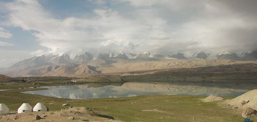
Karakul lake spread its waters in Markansu valley – one of the driest place in Central Asia. Surrounded by high mountains which block humid air masses the valley has less than 30 mm of precipitation a year which is 3 times less than in Karakoram desert. Fluctuation of temperatures is a usual thing for desserts and in Karakul Lake, they are just incredible.
The great Russian Explorer of Pamirs N. Korjenevskiy, describing lake Karakul wrote: “In February, at 9 am the temperature was -35 Centigrade, while at 1 pm the temperature raised up to -6,2 Centigrade and so fluctuation of temperature for 4 hours was 28.8 Centigrade”.
The temperature measurement is taken between 1933 and 1934 shows there were only 15 frost-free days a year and by latest measurements taken in our days, it is known that 67 of 100 years had no frost-free periods at all.
Karakul is Kyrgyz for “black lake” and it indeed looks black when the sun is hidden by clouds.
Karakul has an area of 380 sq km and lies at the altitude of 3914 metres above sea level. It’s the highest lake in the world excluding those in Tibet and even Titicaca lake – the biggest alpine lake in the world is located at lower altitudes.
The lake has 2 basins separated by a peninsula from the south and an island in the north. The island is 8 km long and 4 km wide. The strait between them is 1 km wide. Eastside is 22,5 metres deep, while west basin deepest point is 236 m. There are 3 rivers flow in but these days the lake has no outflow and therefore the water is very salty.
The salt mineralization is constantly increases and 1 liter of boiled out water would leave 7 grams of salt which makes the water undrinkable and useless for watering. Sulphate salt makes water taste brackish.
Karakul’s water level is now much lower than before, but this fact also applies to many other closed lakes of Inner Asia. N. Korjenevskiy noted that before Karakul lake was at least 60 metres above the present level. But even 37 metres is enough to create an outflow to the south where the valley ends up with the flat pass towards Kokuibel valley. This means the lake was much bigger in the past and had an outflow that feeds Pyanj and finally Amudaria River known in the west as Oxus. Its not exactly known when the lake had an outflow, should be an ice age when glaciers were at much lower altitudes and some of them flow down the lake. Later the lake’s territory reduced, the depths diminished, the lake lost its outflow and finally became salty.
The Karakul lake impact structure remained unidentified until the recent geological research undertaken by Russian scientists along with studies of imagery taken from space which let some scholars diagnose Karakul Lake depression as meteorite impact crater with a rim diameter of 52 kilometers and created some 230-190 mln years ago.
A 300 square kilometers (120 sq mi) tract of land including the lake and surrounding mountains has been designated a nature reserve. As well as the lake itself, habitats found in the reserve include rivers, water meadows, broad-leaved and juniper forests, mountain shrub-land and sub-alpine meadows.
Over half of the reserve, comprising 177 square kilometers (68 sq mi), has been identified by Birdlife International as an Important Bird Area because it supports significant numbers of the populations of various bird species, either as residents or as breeding or passage migrants.
The lake Iskanderkul Lake the biggest lake of the Fann Mountains, is located at the height of 2068 m above sea level. The lake has the form of the wrong triangle with the rounded-off corners. Its area is 3.5 sq.km, the largest depth is 72.0 m. almost no aquaticlife is seen in the lake due to the high concentration of minerals and only small loaches survive in waters like this. The set of legends is connected with the Lake Iskanderkul. According to one of them, Alexander of Macedon a great military leader and conqueror once passed with his army through the Fann Mountains, and during the camp of the commander on the coast of the lake, the favorite horse of Alexander — Bucephalus sank in it. By the way, and the lake is obliged by its name to the grand conqueror of antiquity — the name Alexander in Central Asia was pronounced as Iskander.
The highlights of Pamir Mountain Explorer are Yashilkul, Zaroshkul, and Chapdara Lakes with amazing untouched sceneries of the mountains. The route takes you along the border between the Eastern and Western Pamirs, through high mountains at altitudes between 3600 and 4600 m. The horse riding adventure is combined with jeep tour either from Dushanbe to Khorog, via Wakhan (or Shokhdara) valley to Murghab and Bulunkul, or from Osh to Kisil-Art-Murghab-Bulunkul. Short trekking routes are always possible.
The lake was created by a mudslide that sealed off Alichur river in ancient time. The dam is 4 km long and 100 meters thick. The water poured over the south edge gives the beginning to Gunt river- one of Pyanj feeders.
Yashilkul Lake is a freshwater body located in Gorno Badakhshan region of Tajikistan at 3700 meters above sea level. Being 50 meters deep at its deepest point, Yashikul lake is 19 km long and from 1 to 4 km across. The water temperature on the surface never goes higher +14 Centigrade. The water is clean and transparent and so it is possible to observe an aquatic life. The lake feeds the small village of only 25 – 30 houses with trout and Marinka fish all the year round.
The mouth of Alichur river is swampy and therefore bushed with sedge; it is the most shallow, east side of the lake. Near here is a sulphur hot spring of Issyk Bulak with +71 degrees centigrade water.
Local Kyrgyz herders believe the lake is a home for a huge and magic animal – “Tuya Suu” – the Water Camel.
Bulunkul is another alpine lake of Tajik Badakhshan located at the altitude of 3734 m above sea level
Bulunkul Lake is connected with Yashilkul Lake by a narrow channel. The water is fresh and has rich flora and fauna. Flocks of ducks, geese, and seagulls are always can be seen over the lake. Bulunkul lake is the first basin at Pamirs were fishing was introduced to locals and now from May thru October the fishermen set their nets near the mouths of the rivers flow into the lake catching Osman and Marinka.
The lake’s area is also known for being one of the coldest places in Central Asia, the lowest temperature here was registered here at -63 Centigrade.
The best time to visit is July-September. Nearby the lake is a Bulunkul village with homestay available for travellers.
Pamir Highway as the most popular tourist destination is located in Pamir. Pamir is a mountain range with peaks over 7000 meters that takes up most part of Tajikistan; its name is translated as “Roof of the World”
There were once isolated mountain settlements and small states, but in the 19th century, the British and Russian empires began struggling for the influence in Asia known as “the Great Game”. During this confrontation, the English were moving to the north from India to Afghanistan, and the Russians were going from the north via the present territory of Kyrgyzstan and Tajikistan. The urgency to maneuver the troops quickly in case of clash of armies gave a jump to building new roads across mountain regions; this is how the Pamir Highway history get started.
Later, as Tajikistan was declared as a state within USSR, Pamir Highway changed its military significance to trade. The decision led to the development of the region; transport connections between Tajikistan, Afghanistan, and China were settled. Today Pamir tract begins in Dushanbe, the capital of Tajikistan, and goes through Kulab, reaches the river Panj – a tributary of the Amy-Darya River, branches out in Khorog – the capital of Gorno-Badakhshan, and lies via the high-mountain town of Murghab; reaches Osh, the largest city in the south of Kyrgyzstan.
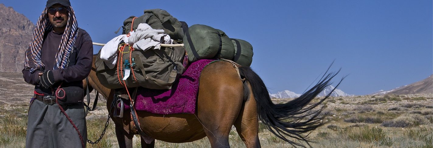
For travelers, Pamir Highway is a unique experience where they learn the culture of Pamir people, history of the region, and enjoy breathtaking landscapes of severe mountains. This is rather tough travel where travelers overcome hundreds of kilometers of bad roads, harsh mountain climate, and spartan accommodation. Nowadays the tourism infrastructure along the Pamir Highway is being developed; although simple, but rather comfortable hotels and guesthouses have appeared. However, it is to consider that the region is far from urban civilization and one will have to live the life of locals, though this is what keeps the entire interest to the Pamir Highway.
As mentioned above, Pamir Highway tour is not an easy trip. The road goes via the highest point of 4655 meters on the pass of Ak-Baytal, where acclimatization is needed. Conveniences such as the internet, comfortable accommodation and good food will gradually disappear. Rocky dirt roads and 8-10-hour daily drives will take all your energy, but all this is worth the unique atmosphere of real adventure where you indulge into the picturesque world of mountains. Every year the number of tourists traveling to Pamir is increasing, and today you will hear different languages. Therefore, if people are traveling there from all over the world, there is definitely something to see. You can reveal the secret of this attraction only by traveling to Pamir Highway.
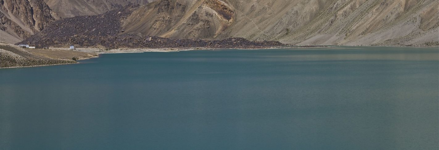
Lake Sarez – Tajikistan’s biggest naturally formed, rock-dammed lake created on 6(18) February of 1911 at 23:15 as a result of the earthquake of 7.5 points according to Richter scale caused a massive landslide of 2,2 km3 which sealed off Murgab river valley and buried Usoi village with all the inhabitants. The created dam is 567 metres tall and 4 km wide and is currently the highest natural dam in the world. A sealed off Murgab river flood the area and another village Sarez located upstream in the same year. A lake was named after Sarez village while the dam is known as Usoi dam after the village buried under the mass of the mudslide. Sarez is the youngest lake in the world. In 1913 the first research showed the lake to be 28 km long, 1,5 km across and 279 m deep. Every day the water level grew up for 36 sm and only in 1914 Sarez waters created an outflow thru the dam and gave a start to Bartang River – one of the Pyanj feeders.
Since then a lake has grown to 55.8 km in length, 3,3 km across and 500 metres deep at its deepest point. The lake’s volume is currently 16, 074 km3 which is equal to Oxus annual discharge. In 1939 a hydrometeorological observatory was opened on the lake’s shore for permanent control over the lake’s waters as some sources believe the lake pose potential risks for downstream communities.
Should another strong earthquake or rock slide occur in the lake’s vicinity, the Usoi dam may give a crack or dam’s ‘right bank’- a partially collapsed body of earth and rock with a mass of roughly 3 cubic kilometers-might fall into the lake. The displacement could generate a wave large enough to wash away Usoi dam and release a wall of water that could flood some 6 million people living downstream along the Bartang, Pyanj and Amu-Darya rivers in Afghanistan, Uzbekistan, and Turkmenistan, as well as in Tajikistan. While catastrophic scenarios about the future of Lake Sarez are easy to come by, measures to mitigate the threats it poses are less so. Scientists still debate on what should be undertaken – some say about pumping station which would pump the water out of the lake the others about the need of drilling into Usoi dam in order to release water in controlled circumstances and reduce the pressures on the structure. In the face of this uncertainty, the government and international community continue to monitor water levels and pressure in Lake Sarez-which, at the moment, seem relatively stable.


 English
 Русский
 العربية